It’s vital to understand how section township ranges influence land ownership near rivers, as this system organizes land into manageable parcels. In this post, you will learn how these divisions, established under the Public Land Survey System, dictate property boundaries and affect land use in riparian areas. By delving into the relationship between these spatial frameworks and river environments, you’ll gain insight into the complexities of land ownership, development potential, and regulatory considerations that impact your property or investment decisions near waterways.
The Genesis of Section Township Range System
The section township range system originated in the late 18th century as a solution to land management challenges faced by the United States government. This system aimed to simplify the process of surveying and selling land, especially as the nation expanded westward. By dividing land into a grid of sections, you find that ownership, purchase, and development become more straightforward, allowing settlers and landowners to navigate property rights effectively around emerging waterways and agricultural areas.
Historical Context of Land Surveys
Land surveys in the United States began in earnest following the Land Ordinance of 1785, which sought to organize land distribution in the newly acquired territories. As settlers moved west, efficient land allocation became necessary for economic growth and community development. This survey method laid the groundwork for clear titles and facilitated the establishment of infrastructure, which was particularly vital near rivers that served as major transportation routes.
Purpose and Structure of the System
The section township range system is structured to promote orderly land development and ownership. Each township is six miles square and contains 36 sections, each one mile square (640 acres). This grid makes it easier for you to identify parcels, improving access to resources and services. Additionally, this systematic approach to defining land boundaries helps prevent disputes over ownership, particularly near rivers where land can easily shift due to erosion or flooding.
This grid format not only promotes clarity but also supports land use planning, enabling both public and private interests to make informed decisions. Each section can be easily sold, developed, or taxed, allowing you to engage in a predictable and organized market. Furthermore, by addressing potential land disputes proactively, this structure ensures that water resources adjacent to these lands are managed effectively, safeguarding both your property rights and the environment. Understanding the layout of this system is vital for strategic land ownership and development, especially in areas prone to changing waterways.
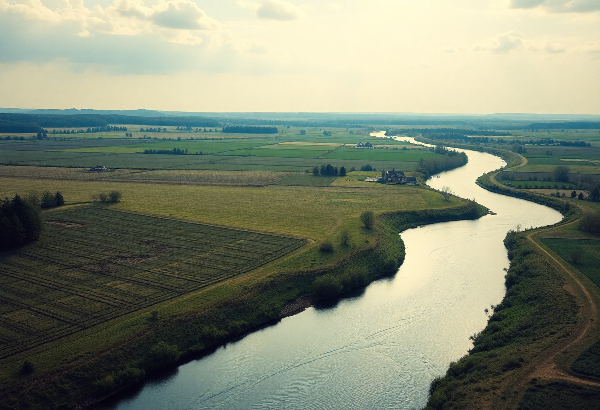
The Connection Between Rivers and Land Use
Your understanding of land use dynamics is deeply intertwined with the presence of rivers. The proximity of rivers affects zoning regulations, agricultural practices, and even residential development. Landowners close to rivers often engage in specific agricultural activities that capitalize on the rich alluvial soils—ideal for crops—while municipalities may shape infrastructure to facilitate access to water resources. This connection emphasizes both the economic value of rivers and their role in societal planning, creating ripple effects that influence how land is utilized in both urban and rural settings.
Ecological Impacts on Property Availability
Rivers have complex ecosystems that can significantly affect property availability. Wetlands alongside rivers may limit development options, creating zones where construction is prohibited to protect flora and fauna. Additionally, the risk of flooding can deter buyers, impacting market prices in flood-prone areas. The adjacent land’s value can fluctuate dramatically due to ecological factors like habitat preservation laws or conservation easements, which seek to maintain biodiversity and safeguard water quality.
Water Rights and Ownership Claims
Your water rights directly influence land ownership claims, particularly near rivers. Different states have distinct laws governing water rights, such as riparian and prior appropriation systems. In riparian states, property owners can claim reasonable use of water adjacent to their land, while prior appropriation states grant rights based on the order of land claims. This can complicate land transactions and create disputes, as securing water access often proves just as vital as the land itself, underlining the intricate relationship between land ownership and water resources.
Understanding water rights can help you navigate potential challenges and opportunities in land ownership. For instance, in regions adhering to prior appropriation principles, a senior water right holder could limit your rights even if you’re adjacent to a river. Familiarizing yourself with local water law is important. You might discover opportunities for leasing or purchasing additional water rights, enhancing your property’s value and utility. Given that water scarcity is becoming an increasing concern, confirming your legal access to this vital resource is a paramount consideration for your land’s long-term viability and marketability.
Navigating Property Transactions in River Adjacent Areas
Engaging in property transactions near rivers necessitates understanding both the logistical and regulatory nuances unique to these regions. Being aware of potential flood zones, zoning laws, and rights to water access can significantly influence your buying or selling experience. Since properties adjacent to rivers often have distinct valuations and development limitations, consider consulting local experts familiar with these elements to optimize your transaction.
Legal Considerations in Land Acquisitions
Land acquisitions near rivers involve several legal considerations that can impact your ownership rights. Regulations regarding floodplain management, easements, and waterways must all be acknowledged before finalizing any agreements. Ensuring that titles are clear and understanding the implications of any existing leases or encroachments will safeguard your investment and future rights to develop or utilize the land.
Best Practices for Buyers and Sellers
Implementing best practices when buying or selling river-adjacent property helps streamline the transaction process. Conduct thorough due diligence, including title searches and environmental assessments. Collaborate with experienced local real estate agents who understand the complexities of these areas and seek legal counsel to navigate any potential disputes regarding water rights or zoning regulations.
In addition to due diligence and legal counsel, active communication with local government departments can provide insights into future developments, zoning changes, or potential environmental regulations that may impact your property. Engaging with community planning meetings can also enhance your understanding of the surrounding areas and prepare you for any shifts in policy that could affect your ownership. Having a proactive approach allows you to make informed decisions and negotiate effectively, ensuring a smoother transaction and a profitable investment.
The Economic Implications of Land Ownership Near Rivers
Proximity to rivers can significantly affect the economic landscape of land ownership. Properties near water bodies often serve different purposes, from recreational activities to commercial ventures, impacting their market demand. The natural beauty and accessibility of riverfront land can generate higher property values, drawing attention from investors and developers. Additionally, these areas often feature enhanced infrastructure, creating a desirable environment for both residential living and business operations.
Property Value Fluctuations
River-adjacent properties experience fluctuations in property values that can stem from various factors, including ecological changes, weather events, and local development trends. Typically, properties that offer scenic views or access to water enjoy higher baseline valuations. However, risks such as flooding and erosion associated with river dynamics can lead to depreciation, compelling landowners to continuously assess market conditions and environmental regulations.
Development Opportunities and Environmental Constraints
Beneath the allure of riverfront development opportunities lies the reality of environmental regulations and land-use restrictions. These constraints are necessary for preserving ecosystems but can limit the types of projects you can undertake. Regulations often address floodplain management, wildlife habitats, and water quality, which may require developers to implement sustainable practices or consider alternative designs. Navigating these constraints can add layers of complexity to any development initiative, making pre-transaction research and due diligence vital.
The balance between development opportunities and environmental constraints is delicate; for instance, some regions allow for commercial ventures, such as resorts or eco-friendly establishments, while others enforce strict zoning laws to protect wildlife habitats. Implementing green infrastructure and obtaining necessary permits can often lead to innovative designs that respect both the land’s economic potential and its ecological integrity. Engaging with local environmental agencies can reveal useful insights into best practices and sustainable models that can turn limitations into opportunities for responsible growth.
Future Trends in Land Ownership by Waterways
The evolving landscape of land ownership near waterways highlights significant trends that could reshape property rights and regulatory frameworks. As urbanization increases and the demand for recreational access to rivers grows, you may find that property values along these areas rise. Moreover, a greater emphasis on preserving natural resources may lead to innovative co-ownership models or land trusts, fostering community stewardship and environmental sustainability.
Climate Change and Its Impact on Land Management
Rising water levels and extreme weather events due to climate change are reshaping land management practices near waterways. You may need to consider how future property values are influenced by flood risks, necessitating floodplain zoning regulations and strategic land use decisions. These adjustments can significantly impact your investment and development approaches in flood-prone areas.
Innovations in Land Use Policy
Innovative land use policies are emerging to address the complexities of ownership and management along waterways. Initiatives like Transfer of Development Rights (TDR) or zoning changes for conservation purposes are gaining traction, allowing you to navigate conflicting interests between development and environmental preservation. Tailored land use policies can help you better align with community goals while maximizing the potential of your property.
For example, local governments are increasingly adopting policies that incentivize waterfront property owners to engage in sustainable practices. These can include tax reductions for natural landscaping or flood mitigation strategies that not only protect your property but also enhance its value over time. Collaborative efforts among stakeholders, including residents and environmental groups, are shaping land use strategies that address community needs while addressing ecological concerns. Embracing these advancements positions you as a proactive participant in the evolving landscape of land ownership by waterways.
Summing up
On the whole, understanding how section township ranges influence land ownership near rivers can enhance your grasp of real estate and land development. These divisions facilitate organized land use, ensuring that properties along rivers are allocated efficiently while maintaining access to water resources. As you consider land purchases or investments, recognizing the layout and legalities of these systems will empower you to make informed decisions that align with your goals. This knowledge is vital as it affects not just ownership but also regulations, zoning, and access rights in river-adjacent areas.