With growing concerns about flooding in riverbank areas, understanding the land grid system is necessary for effective flood management. This systematic approach not only organizes land use efficiently but also helps in controlling water flow during high-risk periods. By integrating various land management practices within the grid, you can enhance the resilience of your local ecosystem and protect your community from the adverse effects of floods. In this article, you will explore how implementing a land grid system can significantly improve flood resilience around riverbanks.
The Foundations of the Land Grid System
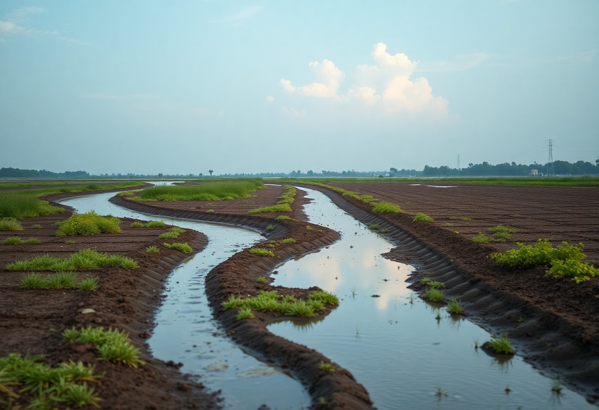
The land grid system serves as a structured framework designed to facilitate efficient land management and urban planning. By segmenting land into manageable units, it enhances the capacity to implement effective flood management strategies along riverbanks. This systematic approach enables planners and engineers to analyze geographic information thoroughly and delineate vulnerable areas that require focused interventions.
Historical Context and Purpose
Initially developed during the early 19th century, the land grid system aimed to promote organized land use and create consistency across urban spaces. It evolved from the need for systematic settlement patterns that would prevent chaos in land distribution. Today, this approach aids in flood mitigation by allowing for better infrastructure planning and resource allocation near riverbanks.
Spatial Organization and Connectivity
Spatial organization within the land grid system enhances connectivity between areas prone to flooding and those designated for intervention. By establishing clear boundaries and access points, the system allows for the seamless transport of resources and emergency response teams to critical locations. It also improves the ability to develop green infrastructure, such as retention ponds, that can absorb excess water during heavy rainfall, further reducing flood risks.
This organized layout not only improves logistical efficiency during flood events but also creates a collaborative environment among different land-use stakeholders. For example, utility companies can coordinate with city planners to enhance drainage systems, while community groups can engage in flood-prevention initiatives more effectively. Consequently, the connectivity provided by the land grid system fosters a comprehensive approach to managing flood risks while enhancing community resilience along vulnerable riverbank areas.
Enhancing Vegetative Buffer Zones
Vegetative buffer zones act as natural barriers that absorb excess water and filter pollutants before they reach the river. The land grid system incorporates these buffers strategically, ensuring that they are positioned to maximize their flood management capabilities. By integrating native vegetation that thrives in local conditions, these zones enhance the landscape’s resilience against flooding events, ultimately protecting water quality and supporting surrounding ecosystems.
Strategic Planting and Soil Stabilization
Incorporating strategic planting techniques within your buffer zones is vital for soil stabilization. Deep-rooted plants help to secure soil layers and prevent erosion, particularly during heavy rainfall. By choosing a diverse array of native species, you promote the establishment of a robust root network that enhances soil structure and permeability, buffering against flood impacts effectively.
Biodiversity and Ecosystem Services
Healthy vegetative buffer zones contribute significantly to biodiversity and provide various ecosystem services. They serve as habitats for wildlife, increase pollinator activity, and improve overall ecosystem functionality within your flood management strategy. The symbiotic relationships within these diverse plant communities allow for better adaptation to changing environmental conditions and stressors, ultimately fostering a balanced ecosystem.
Incorporating diverse plant species increases habitat variety and food sources for many organisms, which is necessary for maintaining balanced ecosystems. For example, the introduction of flowering plants can attract pollinators like bees and butterflies, while also providing food for birds and other wildlife. Moreover, these zones can enhance water quality by filtering sediments and nutrients, thereby preventing harmful runoff from entering the river. Research indicates that restoring even small buffer areas can significantly improve local biodiversity and can reduce flood impact by up to 30%, demonstrating the profound ecological benefits of strategically managing vegetative buffers. These combined benefits highlight the importance of biodiversity as a natural ally in flood management and environmental stewardship.
Optimizing Water Flow and Drainage
Effective water flow and drainage stand at the forefront of successful flood management strategies. The land grid system ensures that waterways are properly integrated with existing infrastructure, allowing for controlled channeling of excess water. Through a meticulously planned layout of grids, you can improve drainage patterns, thereby minimizing water accumulation and reducing flood risks in vulnerable areas.
Design Principles That Prevent Overflow
Incorporating specific design principles, such as grading and slope optimization, helps prevent overflow along riverbanks. By establishing a designated flow path through strategic land use within the grid, you can direct runoff to designated retention areas or bioswales. This proactive approach not only keeps potential flooding events from escalating but also enhances overall watershed performance during heavy rainfall.
Floodplain Management through Grid Adaptability
The adaptability of the land grid system allows for effective floodplain management tailored to fluctuating environmental conditions. With land use changes and climate variables, your approach can evolve as you implement seasonal adjustments, thereby maintaining resilience against floods.
Managing floodplains effectively means being able to adapt grid configurations based on specific events and geographic features. For instance, during heavy rain seasons, you can temporarily convert certain areas within the grid to prioritize water absorption, allowing for natural basin formations. By collaborating with local environmental data, floodplain adjustments can reflect not only current conditions but also anticipate future climatic changes. This dynamic flexibility ensures that your flood management remains proactive, ultimately protecting communities while preserving natural ecosystems.
Community Engagement and Preparedness
Your community’s resilience in the face of flooding greatly depends on engagement and preparedness initiatives. By fostering a culture of active participation, local residents are equipped with the knowledge and skills needed during emergencies. Workshops, town hall meetings, and simulations not only enhance awareness but also build trust among neighbors, enabling timely responses to flood threats. You can play an important role in this collective effort by volunteering in community outreach programs or sharing your insights on effective response strategies.
Empowering Local Stakeholders
Empowering local stakeholders means providing them with the tools, resources, and training necessary to manage flood risks effectively. Engaging local authorities, businesses, and organizations creates a network that enhances communication and collaboration. Your involvement in these initiatives can help amplify voices that are often unheard, ensuring that community-specific needs are addressed in flood management plans, ultimately leading to safer environments for everyone.
Educating Residents on Best Practices
Educating residents on best practices involves sharing valuable information on how to prepare for and respond to flooding events. This may include advising on home reinforcement techniques, evacuation routes, or emergency kits that should be assembled well in advance. You can also participate in local training programs that simulate flood situations, allowing residents to practice their responses in a safe environment, ensuring effective actions are taken when the need arises.
Consider organizing or attending workshops that provide practical guidelines on creating emergency plans tailored to your household and neighborhood. Engaging local fire departments or emergency services in these educational sessions can add an authoritative voice and authentic experience, which significantly enhances learning. Distributing easy-to-understand materials detailing steps to take before, during, and after a flood will be beneficial in improving overall community preparedness. By being proactive, you can contribute not only to your family’s safety but also to the greater good of your community in times of crisis.
Future Innovations in Flood Management
Anticipating future challenges in flood management compels a focus on innovative strategies that incorporate emerging technologies alongside established practices like the land grid system. By envisioning enhancements that respond to climate change and population shifts, you can contribute to a more adaptive and resilient approach to managing flood risks around riverbanks.
Integrating Technology with Land Grid Systems
Utilizing cutting-edge technologies elevates the effectiveness of land grid systems in flood management. Geographic Information Systems (GIS) play a pivotal role by allowing you to analyze terrain, hydrology, and population density. By modeling flood scenarios, you can optimize land use planning, ensuring that flood-prone areas are effectively managed while enhancing overall community resilience.
Policy Frameworks Supporting Sustainable Practices
Implementing robust policy frameworks is imperative for supporting sustainable flood management practices. Through regulations and incentives, your community can promote responsible land use and investment in green infrastructure, such as permeable pavements and restored wetlands. These initiatives foster resilience by allowing natural absorption and filtration of stormwater, reducing the overall flood risk.
In order to effectively support sustainable practices, policy frameworks must prioritize collaboration between local governments, environmental agencies, and community stakeholders. You can advocate for policies that encourage investment in green infrastructure and adaptive land use planning. For example, creating incentives for developers to incorporate flood-resistant designs not only protects properties but also enhances public safety. Integrating flood risk assessments into zoning laws ensures that all new projects consider their potential impact on surrounding areas, fostering a proactive approach that prioritizes long-term sustainability.
Summing up
Taking this into account, the land grid system effectively enhances flood management around riverbanks by allowing you to implement structured land-use planning and drainage strategies. By promoting strategic zoning, you can minimize flood-prone areas and improve water flow management. This system empowers you to make informed decisions about infrastructure placement and agricultural practices, ultimately reducing the risks associated with flooding while increasing the resilience of communities. Through efficient land use, you can harmonize development needs with effective flood management strategies, improving safety and sustainability in flood-prone regions.