It’s vital to understand how rivers interact with section township ranges, as this knowledge can significantly enhance your grasp of land management and environmental planning. As you explore the complexities of land division in the United States, you’ll discover how rivers influenced property boundaries and how they impact agricultural practices, urban development, and environmental conservation. This intersection of natural geography and human-made systems reveals a layered relationship that can inform your decisions, whether you’re involved in real estate, resource management, or simply curious about land use in your community.
The Geographical Foundations of Section Township Ranges
Understanding the geographical foundations of section township ranges is pivotal. These divisions of land emerge from the Public Land Survey System (PLSS), which organizes land into a grid of townships and sections. Each township typically covers six miles square, subdivided into 36 sections, each consisting of one square mile or 640 acres. This system minimizes confusion in land ownership and designates clear boundaries, ensuring that you can navigate and appreciate the land with ease.
Defining Section Township Ranges
Section township ranges provide a systematic approach to land division, allowing for efficient management and ownership transfer. Within this method, a township is further divided into four quadrants, shape each section distinctly, streamlining land transactions and legal descriptions. You’ll find that these divisions promote clarity in legal documentation and ease in locating properties, which is especially beneficial in areas with diverse landscapes.
The Historical Significance of Land Division in the U.S.
The historical significance of land division in the U.S. is deeply intertwined with the nation’s expansion and development. Established through the Land Ordinance of 1785, section township ranges facilitated westward expansion and the orderly survey of new territories. You can trace the creation of many towns, farms, and communities back to this structured system, which not only encouraged settlement but also shaped American agriculture and industry.
As settlers ventured into uncharted territories, the systematic approach of section township ranges provided an vital framework for establishing land ownership and governance. The predictable layout served to create towns and cities linked by accessible roads, fostering connectivity. For instance, settlements like Chicago and Denver emerged from this systematic land division, reflecting how these foundational principles influenced urban development. Today, understanding this historical context helps you appreciate how land divisions continue to affect land management, zoning laws, and regional planning across the nation.
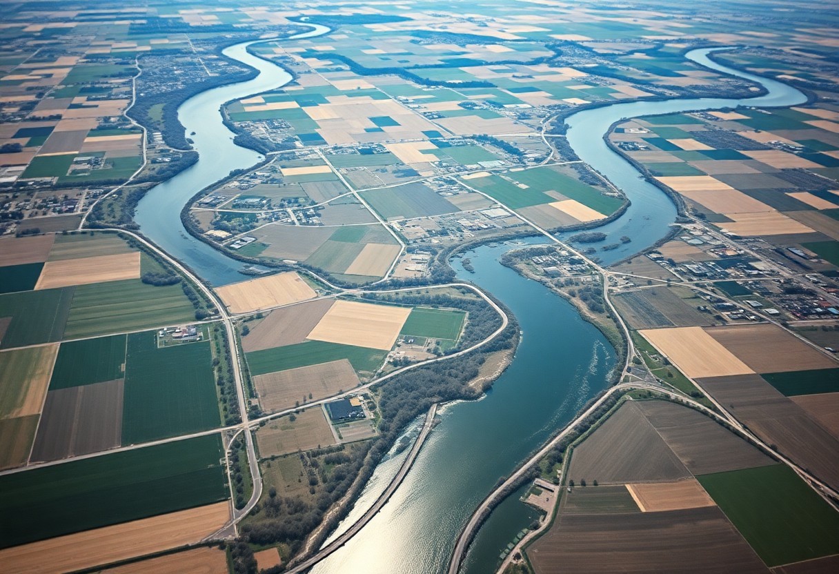
Rivers as Natural Dividers: The Role of Hydrology
Hydrologically, rivers serve as dynamic natural dividers that influence various aspects of land use and property boundaries. Their meandering paths can dictate jurisdiction lines, historical divisions, and even political boundaries. The constant flow of water shapes the land, eroding soil and depositing sediment, which can shift boundaries over time and redefine the landscape’s hydrology. Understanding these fluid dynamics ensures more informed decisions in land management and urban planning, particularly concerning development near river systems.
How Rivers Shape Land Boundaries
Rivers often create distinct land boundaries that reflect both natural and administrative divisions. For example, many counties and townships in the United States use rivers as borderlines, aligning property lines with geographic features. These boundaries can be complex, as rivers may shift, change course, or experience flooding, leading to disputes and legal challenges over land ownership and rights. The reliance on rivers as land markers necessitates flexibility in boundary definitions to accommodate these natural changes.
Navigating Watersheds: Understanding Their Impact on Township Layout
Your approach to township layout directly ties into the understanding of watersheds, as these areas dictate water flow and drainage patterns. Townships built in proximity to rivers must account for watershed boundaries, influencing infrastructure planning, agricultural land, and residential development. By considering the watershed’s contours, you can minimize flooding risks and ensure sustainable water management practices that protect both the environment and community interests.
A well-designed township relies on the natural gradient and flow of water within its watershed to inform key planning decisions. For instance, zoning laws may restrict certain types of development in flood-prone areas, while encouraging green spaces along riverbanks to enhance water absorption. Moreover, public facilities, such as roadways or parks, are strategically placed to both respect watershed boundaries and facilitate drainage. Understanding your township’s watershed can elevate land stewardship and promote ecological health, ensuring that community growth harmonizes with the lifecycle of water resources. Proper management of these elements not only protects the natural environment but also enhances quality of life for residents—by providing recreational areas and maintaining property values in flood-prone zones.
The Legal Framework Governing Water and Land Interactions
Navigating the legal intricacies of water and land interactions requires understanding a complex framework, including federal and state regulations, local ordinances, and overarching environmental laws. Various laws delineate how water rights are allocated, prioritize uses, and manage water quality, influencing not just landowners but entire communities. For those engaged in real estate, agriculture, or development, the implications of these regulations can be significant, dictating the terms under which land and water can be utilized.
Water Rights and Regulatory Challenges
Water rights, often characterized by a “first in time, first in right” principle, can lead to disputes when new demands on rivers and streams arise. Regulatory challenges include managing competing interests between agricultural needs, urban expansion, and ecological preservation. Property owners must navigate permits, licenses, and environmental assessments that can slow development and complicate land management strategies.
Case Law: Precedents Affecting River and Township Conflicts
Past legal decisions shape the dialogue surrounding water rights and river use within township ranges. Case law often establishes precedents that can either affirm or contradict the rights of landowners and municipalities in disputes over water allocation and usage. For example, the landmark case of *Sierra Club v. Morton* highlighted the tension between conservation efforts and land development, illustrating how courts have occasionally sided with environmental protection over economic expansion.
In more specific terms, cases like *Klein v. Harker Heights* have underscored the responsibility of municipalities to manage water pollution, reinforcing that local governments can be held accountable for how their actions affect river health. The rulings often point to a broader necessity for sustainable water management, a principle that could impact future land use planning and the rights of property holders. Engaging in diligent research of relevant case law is important, as each decision can redefine your approach to land development and water usage, potentially affecting your legal standing and financial investment in the long run.
Ecological Interconnections: Rivers and Their Influence on Land Use
Rivers play a significant role in shaping land use patterns, acting as both ecological corridors and boundaries that influence human activities. Floodplains, for instance, are often designated for agriculture due to the rich alluvial soils formed by sediments during flooding events. This natural resource, combined with access to water, encourages settlement and development in river valleys. As a result, the interplay between river systems and land use shapes communities, economic activities, and conservation efforts in various ways.
Biodiversity and Ecosystem Services Provided by Riverine Systems
Riverine ecosystems support an impressive array of biodiversity, providing habitat for countless species of fish, birds, and plants. Beyond serving as habitats, rivers deliver vital ecosystem services such as water purification, flood regulation, and nutrient cycling. These services can significantly enhance your local environment and contribute to the overall health of terrestrial ecosystems, fostering a thriving balance between natural systems and human needs.
Agricultural and Urban Planning in Relation to River Dynamics
Your agricultural and urban planning practices must consider river dynamics for sustainable development. Proximity to rivers not only offers irrigation opportunities but also presents challenges such as flood risk and water management. By integrating floodplain zoning and water resource management into planning processes, you can mitigate flooding risks while optimizing land use, ensuring that both agriculture and urban centers thrive harmoniously alongside river systems.
Effective agricultural and urban planning in relation to river dynamics requires a nuanced understanding of how rivers behave during different seasons. For instance, seasonal floods can affect crop yields and influence where urban development occurs. Implementing riparian buffers, preserving wetlands, and adopting flood-resilient landscaping practices can limit adverse impacts while enhancing the agricultural potential of river-adjacent lands. Utilizing advanced modeling tools and collaborating with environmental experts can help you forecast river behavior, allowing for informed decisions that respect natural rhythms and protect community interests.
The Future of Rivers and Land Management: Anticipated Changes
The landscapes shaped by rivers will undergo significant transformations as climate variability, urbanization, and population increases impact land management strategies in the coming years. Fostering sustainable practices and understanding the intricate relationship between river systems and township ranges will take center stage as communities prioritize resilience against environmental shifts. You’ll see a movement towards collaborative efforts among stakeholders to safeguard water resources, maintain biodiversity, and enhance land use efficiency, paving the way for more holistic stewardship of these critical ecosystems.
Climate Change Impacts on River Systems and Township Ranges
As climate change continues to escalate, river systems and the configurations of township ranges are at risk of severe alteration. Fluctuations in precipitation patterns can lead to unpredictable flooding or prolonged droughts affecting soil health and water availability. You might notice changes in water temperatures, which stand to disrupt aquatic habitats, ultimately impacting species diversity in local ecosystems. With these challenges, the need for adaptive management strategies within township frameworks will be paramount to sustain both agricultural and ecological integrity.
Innovative Approaches to Sustainable Land and Water Management
Adopting innovative methods and technologies for sustainable land and water management is vital for addressing the challenges posed by changing river dynamics and land use pressures. You could explore practices such as integrated watershed management, which incentivizes cooperation among landowners to maintain water quality. Utilizing GIS technology to analyze land characteristics assists in making informed decisions about optimal land use. Community-driven initiatives, like rain gardens or permeable pavements, also reflect a growing trend towards incorporating natural processes into urban planning. These techniques collectively promote resilience and sustainability within your township range.
Incorporating innovative approaches requires an understanding of both traditional and modern farming methods, alongside community involvement. For instance, agroforestry combines agriculture with forestry to create diverse ecosystems that improve soil conservation while enhancing local water systems. Programs that incentivize the use of cover crops help mitigate soil erosion and increase water infiltration. With ongoing technological advancements, you’ll find that precision agriculture, which employs data-driven decision-making, is emerging as a vital tool for optimizing land resources. Collaboration among farmers, government officials, and environmental groups fosters a holistic framework for managing land and water sustainably, ensuring vital resources remain intact for future generations.
Summing Up
Now, as you explore the intersection of rivers and the intricacies of section township ranges, you gain a deeper understanding of how natural landscapes shape human endeavors. You realize that rivers not only provide imperative resources but also influence land use, settlement patterns, and property divisions within these surveyed areas. By integrating your knowledge of hydrology with land surveying, you can appreciate the complex relationship between these elements, enriching your understanding of both geography and planning.